
 After a few "Points of Interest" the tops of the Tepees come into view, then the road swings down and offers two pullouts. We park at one and head for two huge formations on the west side. As we pass the second one, we notice at its base an interesting drainage with wall of light cobalt green, blue, ochre and red in fascinating textures and shapes. It reminded me of the drainages I loved in the Badlands NP where every sharp turn revealed something wonderful. It isn't a long drainage, the passable route ends with a tumble of boulders and tumbleweed under an arch of mudstone. With the rain yesterday, we speculate that collapse could come at any time and retrace our steps out of the drainage to view its continuation from above, which looks like a scale model of the badlands. That's why it's so hard to just distance here, a badlands formation can be 10 inches high or 100 feet. It looks the same. It's a fractal world out here.

 We cross the road and head for the "tepees" to see how far into, or over them, we can get. The tepee shaped monuments are banded with blue and red and crowd together to form a wall, too steep and smooth to climb. We head between them where zigzag drainages of a different sort allow access in single file between the monuments. I keep thinking our path will narrow but instead, several join and the path continues a gradual climb till we come out on the top. From there are great 360 views, and great treasures at our feet. Shards of petrified wood, as colorful as the examples in the park's celebrated "Crystal Forest", and sheets of mica emerge from the mudstone, all glittering in the sun. Other petrified wood looks like the aftermath of a log-splitting frenzy, the same colors and textures as firewood, but hard as stone
.


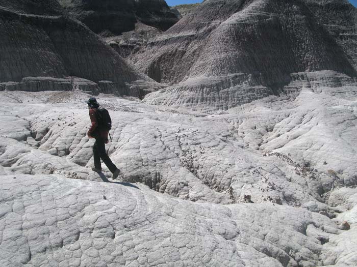
 We follow the summits south. Much of the surface is covered with a brown crust, like the frozen chocolate eclair bars I had as a kid. There are also many sinkholes that I give wide berth. I'm not sure how far you would go if you were to step into one but I know they empty out in little caves below, so I'm not taking a chance. Spotting a group of hoodoos we hike to them. They had looked so high we are surprised to be able to climb right next to them and joked about giving the precariously balanced ones just a little push. (We didn't). From there we look towards a mesa wall and consider hiking along it, later we realize that it is actually Blue Mesa that we are looking at from below. Instead we look for a way down and once again, the drainages are the best route. This one is bluer and its bed is mucky and slippery, due to the rain the day before. It soon encrusts our boots with badlands cement.


No comments:
Post a Comment